Odisha Economic Corridor
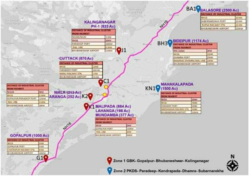
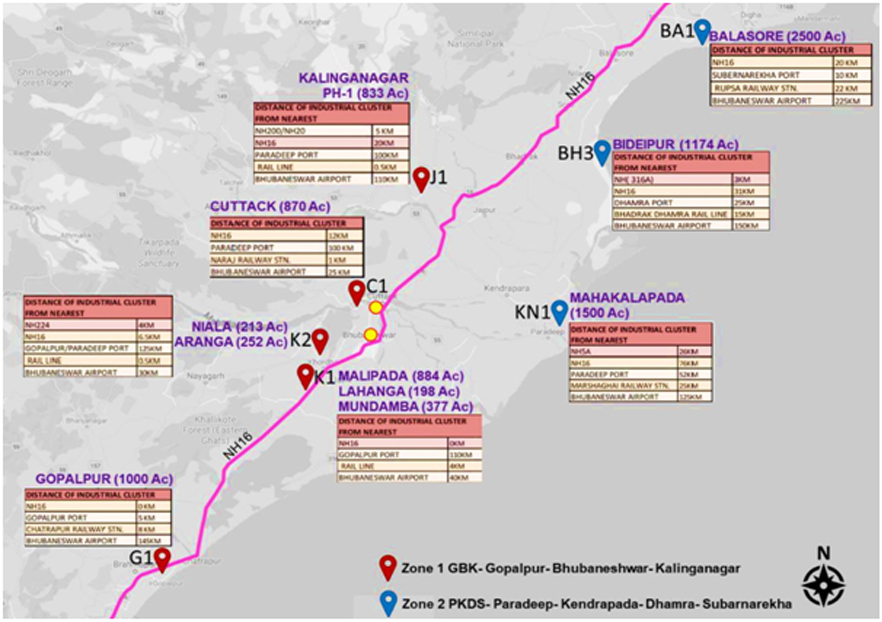
The Odisha Economic Corridor (OEC) is poised to play a pivotal role in the East Coast Industrial Corridor (ECIC), the first coastal corridor of India. The Odisha Economic Corridor comprises 11 industrial clusters spanning approx. 600 km along the NH 16, with a total project area of 11,366 acres of land. They are classified into two zones namely,
Gopalpur- Bhubaneswar- Kalinganagar Node and Paradip- Kendrapada- Dhamra- Subernarekha Node
Zone 1 GBK (4748 Acres): Gopalpur-Bhubaneswar-Kalinganagar
Zone 1 is 260 km along the NH16. The 11 sites of the OEC can be classified into two sections based on their proximity to the coast and the type of industry they can support. The GBK includes J1 (Kalinganagar), C1 (Cuttack), K1 (Malipada, Lahanga, Mundamba), K2 (Niala, Aranga) and G1 (Gopalpur).
Zone 2 PKDS (6618 Acres): Paradip- Kendrapada- Dhamra- Subernarekha.
Zone 2 is 256 km along the NH16. The PKDS includes KN1 (Mahakalapada), BH3 (Bideipur) and BA1 (Balasore).
Bundling of inland and coastal sites will aid in the provision of resources and infrastructure networks. The inland section of industries has the advantage to ease connectivity to other cities and economic centres. The coastal section can support industries that require connectivity to the ports or other logistical networks.
Consultant has been appointed for preparation of detailed master plan and preliminary engineering for the project.
Important Links: NICDC Official Website

